
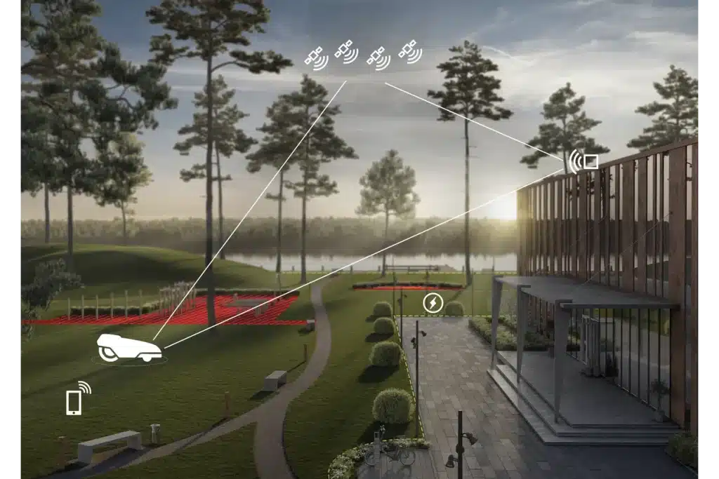
Stay-out zone
Virtual boundary
Define the mower’s work area by using appDrive function in the mobile app to drive the mower around the area that shall be mowed.
Satellite signals
Satellite signals are received by both the mower and the reference station. To achieve up to centimeter level accuracy a technique called RTK-GNSS is used. It enhances the precision of satellite position data.
Navigation satellites
Global navigation satellite system (GNSS) provides satellite signals to the mower and the reference station. A minimum of four satellite signals are needed for both the mower and the reference station. The following GNSS satellite systems are used: GPS, GLONASS, BeiDou and Galileo.
Reference station
A fixed reference station is required to reach a high precision of the mower’s position. The reference station broadcasts correction data to the mower.
Correction data
Correction data from the reference station is required to operate the mower at all times and to keep a high level of accuracy of the mower’s position.
Charging station
The place where the mower automatically returns to recharge its batteries.

